|
|
![]()
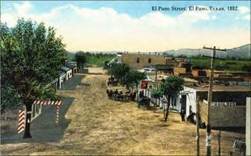
The fourth largest city in Texas, El Paso is steeped in 500
years of rich history and culture. El Paso is a unique blend of
twenty-first century cosmopolitan living and Old West pioneer spirit. The
city shares a border with Mexico.
For millennia Indians (indigenous peoples) traversed the El Paso area, then the first Europeans came through the Pass of the North in 1581.
In 1598 the Juan de Ońate expedition celebrated the first Thanksgiving on United States' soil. Don Juan de Ońate was one of the earliest Spanish conquistadors to enter what is now North America. He led his men through the mountains and named this pass "El Paso del Norte."The Pueblo Revolt in New Mexico in 1680 forced Spanish settlers back south of the Rio Grande. Many settled along the river at the Pass of the North, primarily on the south side of the river.
For the next few centuries the Spanish settlements along the border flourished. The historic missions in Ysleta, Socorro and San Elizario were founded; these simple, austere monuments to an age-old religious tradition still stand today. In the beginning, El Paso's economy was agriculture, mining and transportation. El Paso was an important stop on the Camino Real that served the Santa Fe Trail and the interior of Mexico.El Paso officially became part of the United States when Texas joined the Union in 1845.
The Mexican War of 1846 assured the settlements on the north side of the Rio Grande to be part of the United States.The first military post was established along the American side of the river in 1849 in order to protect the route to the gold fields farther west. Ft. Bliss had several locations before expanding into its permanent location and becoming a major training and missile defense center.
Sides were taken during the Civil War, but the War did not have major impact in the El Paso area. The growing town recovered quickly.El Paso was originally known as Franklin. It was incorporated in 1873 and encompassed the small area communities that had developed along the river (Magoffinsville, Concordia, Hart's Mill).
In 1881 the railroad arrived. Business expanded rapidly, and today's modern city developed.Control of the Rio Grande was begun with the building of dams upstream and channelization.
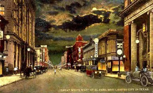
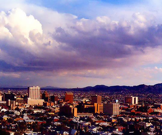
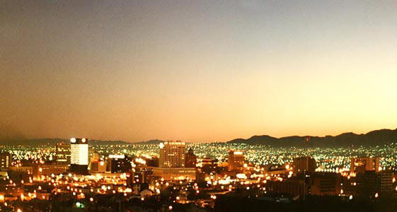
In 1913 the College of Mines, now The University of Texas at El Paso, was chartered by the State of Texas. El Paso developed rapidly and prosperously, and became known as "The Best Lighted City in Texas."Downtown 1930s
Downtown 1950s
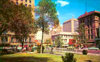
The Franklin Mountain State Park was created in 1979. It is the largest urban park in the United States and features exceptional geologic history and the highest structural point in Texas.
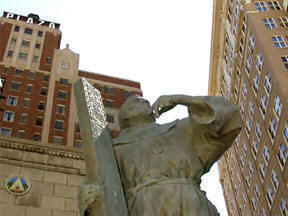
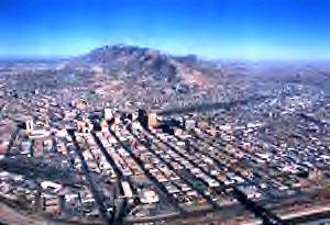
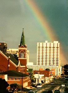
El Paso History Tip from Hap Lamberth:
"The book Frontier College, The First Fifty Years by Francis
Fugate was published by Texas Western Press in 1964 and is one
of the most factual and thoroughly researched books on the origins
and growth of TCM-TWC-UTEP. Also good school synopsis referencing
the book at: http://www.tshaonline.org/handbook/online/articles/UU/kcu11.html
![]()
There is virtually no recorded history of the Juarez area prior to the arrival of Spanish missionaries in the late 1500s. Indians had lived in the valley along the Rio Grande for hundreds of years. The Juárez/El Paso area was a logical place to visit and settle because of the river, and the natural pass through the mountains which gave the area its name, Paso Del Norte – the Pass of the North.
Spaniard Don Juan de O
ńate came to what is now Juarez-El Paso in 1598. He and his group had traveled north from where Mexico City is now, trailblazing the path that was to become the primary road of commerce for the next two centuries between Mexico and the United States, the Camino Real (King's Highway). Two groups of Indians, the Sumas and the Mansos, were living in the area when Ońate's party arrived.The Rio Grande (or Rio Bravo) was often a raging river; with no bridges to cross, travelers often were forced to wait on one side or the other for months until the waters subsided enough to allow crossing.
In 1659, Fray Garcia de San Francisco y Zuniga began constuction of a mission church to serve the Mansos Indians. In 1668, the structure was completed, and the town that we now know as Juarez, with a population of more than a thousand people, began its development. This same church still stands today just a few blocks from the City Market in downtown Juarez.
In 1680, the Pueblo Indians living in what is now Santa Fe, New Mexico revolted, and 2,000 Spanish and Indian refugees fled south toward Paso del Norte. When they arrived in October 1680, they effectively doubled the population of the town. To accomodate the influx of people, three more towns were built along a twelve-mile stretch of the south side of the river.
Paso del Norte grew slowly in the 18th and 19th Centuries. The area was mostly a stopover point for north-south and later east-west travelers.
Texas won its independence from Mexico in 1836. The Rio Grande became an unofficial international boundary but was not recognized as such in an area where no such thing had been known before.
The Mexican War of 1846 legally confirmed the Rio Grande as the international boundary through the Treaty of Guadalupe-Hidalgo. During the war, American forces defeated the Mexican army at the Battle of Brazito.
The state of Chihuahua established a free trade zone in 1858. It lasted for a number of years.
In 1865, with the French forces led by Maximilian in control of Mexico City, Benito Juarez, the elected president of Mexico, fled north to Paso del Norte. The city served as the capital of Juarez's Mexico government until June 1866, when the French were driven from the country. The Mexican revolutionaries were under the direction of Benito Juárez, who found refuge in the border area during the course of the revolution.
Not long after returning to Mexico City, Juarez decreed that a railroad be built from Paso del Norte all the way to the state of Sonora. In 1888, the congress of the state of Chihuahua changed the name of the city to Ciudad Juarez (The City of Juarez) to honor this most-beloved hero of the revolution against France.
The Mexican-Revolution of 1910-1920 greatly affected the border towns of Juárez and El Paso. Many Mexican residents fled to the north in order to avoid the fighting.
Pancho Villa raided Columbus, New Mexico in 1916 resulting in John J. Pershing's Expedition into Mexico to catch Villa.Prohibition (the banning of alcohol production, sales and consumption) in the United States in 1920 brought a new boom to Juarez. The city became a center for entertainment for El Paso and the entire southwestern United States. Restaurants, nightclubs, gambling establishments, a racetrack, along with less respectable businesses, flourished. The El Paso Electric Company even operated a streetcar system connecting El Paso and Juarez with a fare of only 6˘. This was the time when Juarez developed a reputation for everything from fine restaurants to illicit entertainment. Much of the reputation lives today –– some true and some not. While Americans went to Juarez for entertainment, Juarenses typically came to El Paso to shop during this period. This phenomena continues today.
During the 1930s and 1940s, the economic fortunes of Juarez rose and fell with that of the United States. The end of Prohibition reduced tourism in Juarez, and the depression slowed the economy of both El Paso and Juarez. World War II brought a new boom to Juarez as the general economy improved, and the huge influx of U.S. servicemen to Fort Bliss frequented Juarez entertainment centers.

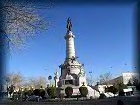
The period from 1960 thru the 1980s saw increased industrialization of Juarez. The Border Industrialization Program initiated the maquiladora, or twin plant, program where American companies opened factories in Mexico to take goods, raw materials and work-in-progress from the U.S., assemble it in Mexico, then ship it back to the U.S., paying duties only on the value added.
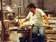
Glass-blowing plant in Juarez
In 1967, Mexican President Gustavo Diaz Ordaz and U.S. President Lyndon B. Johnson met in El Paso and Juarez to officially transfer to Mexico lands that had become part of the U.S. when the Rio Grande changed course during flooding. This land can now be identified as the Chamizal Parks in Juarez and El Paso. The Rio Grande now passes through Juarez and El Paso in a man-made canal so it can't change its course and consequently move the international border.
The North American Free Trade Treaty was signed in 1992 and went into effect in 1994. A strong international trade arrangement resulted.
Today, with a population of over 2 million people, Juarez is one of the largest cities in Mexico. Growth is still fueled by the maquiladora program and the general belief that economic opportunities are better in the north.
To read El Paso and Juárez history in detail, the following books are recommended:
Dr. C. L. Sonnichsen, 1968 & 1980. Pass of the North. 2 vols. El Paso: Texas Western Press.The Handbook of Texas, 1996. Ron Tyler, ed. 6 vols. Austin: The Texas State Historical Association. On the web at http://www.tsha.utexas.edu
Dr. W. H. Timmons, 1990. El Paso: A Borderlands History. El Paso: Texas Western Press.
Dr. W. H. Timmons, ed., 1980. Four Centuries at the Pass. El Paso: 4 Centuries 81 Foundation.
Prof. Armando B. Chávez M., 1991. Historia de Ciudad Juárez Chihuahua. Mexico, D.F.: Editorial Pax Mexico.
Oscar J. Martinez, 1978. Border Boom Town, Ciudad Juárez Since 1848. Austin: University of Texas Press.
Ralph Roeder, 1947. Juarez and His Mexico. 2 vols. New York: The Viking Press.
Dr. C. L. Sonnichsen, 1968 & 1980. Pass of the North. 2 vols. El Paso: Texas Western Press.